Click to Enlarge Image
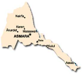
Location: Eritrea is located along the Red Sea, north of the Horn of
Africa, between Djibouti and Sudan. Eritrea’s longest border is shared
with Ethiopia to the south.
Size: The total area of Eritrea, including the Dahlak archipelago off
Massawa, is 124,320 square kilometers.
Land Boundaries: Eritrea shares a 1,626-kilometer border with three nations: Sudan to the north and west (605 kilometers), Ethiopia to the south (912 kilometers), and Djibouti to the southeast (109 kilometers).

Click to Enlarge Image
Disputed Territory: In December 1995, Eritrea entered into a dispute with Yemen over claims to the Hanish Islands and fishing rights in the Red Sea. This dispute was resolved in 1999 when the islands were awarded to Yemen through international arbitration, and the Eritreans complied with the verdict. A territorial dispute along Eritrea’s border with Ethiopia erupted into conflict in 1998. Despite a cease-fire followed by a peace agreement in 2000 and the rendering of an arbitration decision by the Ethiopia-Eritrea Boundary Commission in 2002 as part of the peace arrangements, the dispute has yet to reach a peaceful resolution. Ethiopia has rejected parts of the arbitration decision and has called for dialogue, whereas Eritrea has called for implementation of the decision as a condition for dialogue. As of mid-2005, the United Nations Mission in Ethiopia and Eritrea maintains approximately 3,300 troops in a 25-kilometer wide Temporary Security Zone on the Eritrean side of the disputed border in an effort to monitor the 2000 cease-fire.
Length of Coastline: Eritrea’s coastline is 2,234 kilometers long, with 1,151 kilometers along the Red Sea and 1,083 kilometers of island coastline in the Red Sea.
Maritime Claims: Eritrea’s maritime claim in the Red Sea extends 12 nautical miles.
Topography: Eritrea’s topography can be divided into three broad categories: the arid, narrow lowland strip along the Red Sea; the north-central region, which is an extension of the Ethiopian Plateau and is dissected by river valleys; and the western plain along the Sudanese border. The highest point is Emba Soira, southeast of Asmara, at 3,010 meters; the lowest is in the Denakil Depression along the Red Sea, which at places is 130 meters below sea level.
Principal Rivers: The Setit River is Eritrea’s only perennial waterway, albeit a non-navigable one. It flows from Ethiopia (where it is called the Tekezé) along the western border and into Sudan (where it is known as the Atbara). The other rivers in Eritrea, all of which are seasonal during the rainy season, are the Anseba, the Barka, and the Mareb, which is known as the Gash in its lower course in western Eritrea and which forms a part of the border between Eritrea and the Ethiopian province of Tigray.
Climate: Eritrea’s highlands are located on the highest landmass on the African continent and, therefore, have much cooler, damper weather than the semi-arid coast along the Red Sea and in the western hills and lowlands. The average temperature in Asmara is 16° C, whereas in Massawa (on the coast) it is 30° C and can reach 50° C. Average rainfall in Asmara is 508 millimeters per year; in Massawa it is only 205 millimeters per year. The Denakil Depression is one of the hottest places on earth.
Natural Resources: Resources in Eritrea include barite, copper, feldspar, fish, gold, kaolin, potash, salt, and zinc. Reserves of oil and natural gas also may exist.
Land Use: Less than 5 percent of the land in Eritrea is arable, and permanent crops occupy a mere 0.03 percent of total land area. Most land is suitable only for pastorage, but some areas, such as the Red Sea coast and the far north, are too arid even for this purpose.
Environmental Factors: Eritrea faces continued deforestation, desertification, soil erosion, overgrazing, and significant land loss as a result of the presence of hundreds of thousands of land mines.
Time Zone: Eritrea is three hours ahead of Greenwich Mean Time.